Physical Address
304 North Cardinal St.
Dorchester Center, MA 02124
Physical Address
304 North Cardinal St.
Dorchester Center, MA 02124

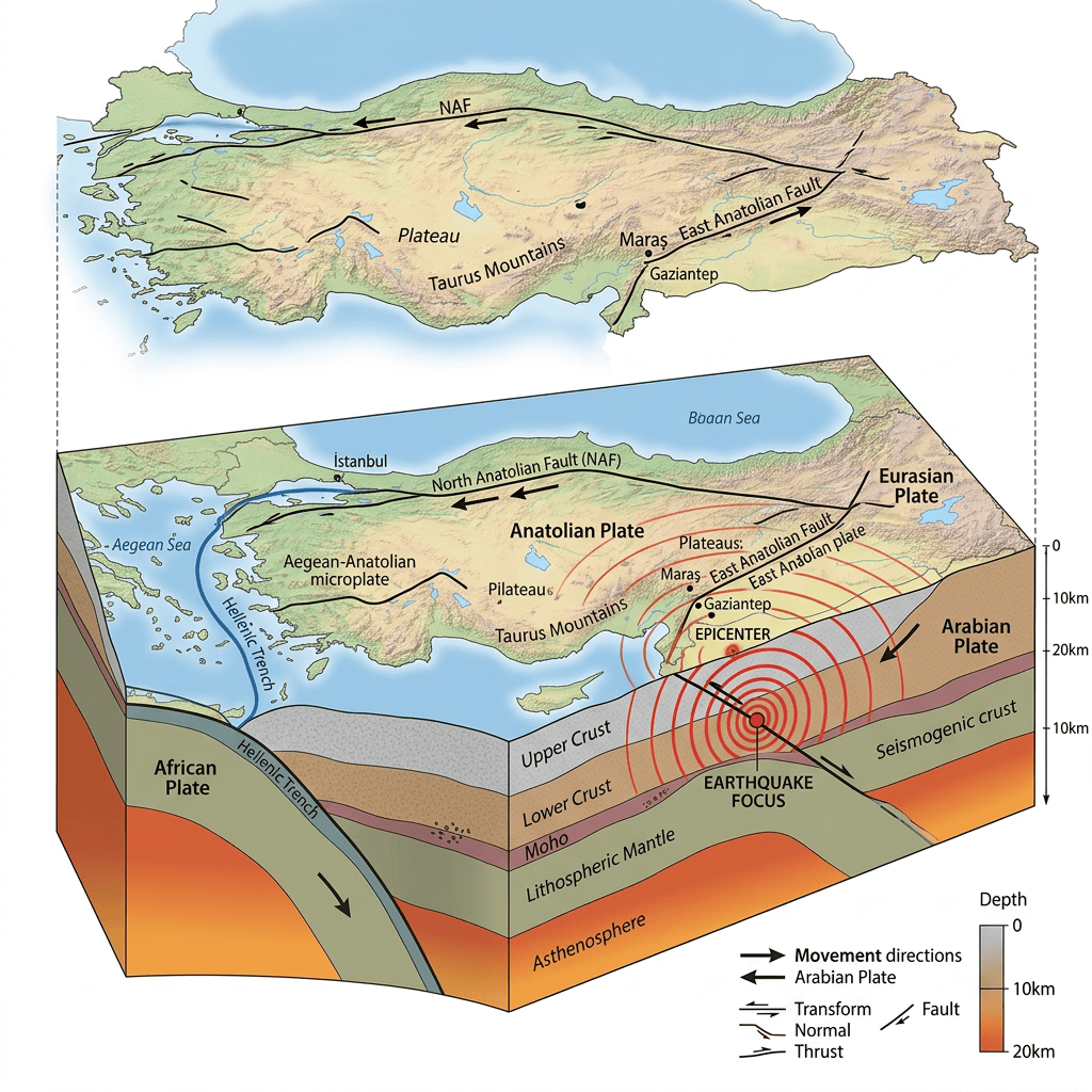
A magnitude 4.9 earthquake struck central Türkiye on 15th November 2024, occurring at a shallow depth of 10 km. The tremor was felt across several towns and districts, though early reports indicated no major damage or casualties.
The quake occurred in one of Türkiye’s active tectonic regions, where the Anatolian Plate interacts with both the Arabian Plate and the Eurasian Plate. Because the earthquake was shallow, residents experienced noticeable shaking even though the magnitude was moderate.
People across the region reported:
Emergency services monitored the situation closely following the event.
Related Guide
How Earthquake Magnitudes Are Calculated
Local authorities confirmed:
Some residents briefly evacuated buildings as a precaution, following standard earthquake‑safety behaviour common in Türkiye.
Türkiye’s disaster‑management agencies:
Officials also reminded residents of earthquake‑preparedness guidelines, especially in regions with a history of seismic activity.
Central Türkiye lies near several major fault systems, including:
Earthquakes of magnitude 4.5–5.0 are common due to:
A shallow depth of 10 km often makes shaking more noticeable but typically limits widespread damage.
Related Guide
What Is a Subduction Zone? Understanding One of Earth’s Most Powerful Geological Features
Subscribe to get the latest posts sent to your email.
